All posts by admin

Southern River

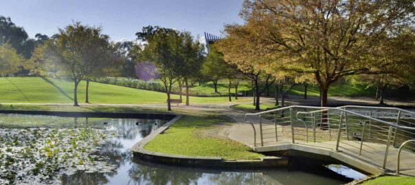
Named after the river that runs through the area, Southern River is part of the City of Gosnells locality. Spanning 14 square kilometres, Southern River provides a family-friendly lifestyle. Extensive urban development in the early 2000s saw the suburb subdivided and urbanised into the functional area it is today, with care taken to preserve much of the wetlands for public recreation.

Life in Southern River

Bound by Southern River Road and Wungong Brook in the north, Tonkin Highway in the east, Ranford Road in the south and Warton Road in the west, Southern River has plenty to offer its residents. One of the highlights of the suburb is Sutherlands Park, a large sporting complex that provides a focus for cricket and football for Southern River, Thornlie and Gosnells. Other notable parks and reserves include Castlewood Parkway and Sanctuary Waters, both of which are built around a lake. Local schools in the area include Bletchley Park Primary School, Southern River College and Thornlie Christian College.

Southern River Facts

Distance to Perth(km): 18
Postcode: 6110
Local Government: Gosnells
Local Schools: Bletchley Park P.S., Southern River P.S., Thornlie Christian College
Nearby Schools: St Munchin’s Catholic School (Gosnells) , Sacred Heart Primary School (Thornlie)
Nearby Shops: Southern River Shopping Centre
Train Stations: Southern River
Bus Services: Bus to Murdoch Train Station

(Source:REIWA)

Seville Grove

With a population of just over 9000, Seville Grove is a relatively recent and still developing residential area. Located just 5km from the heart of Armadale, major features of the area include Polytechnic West Equine Training Centre, Champion Drive Shopping Centre, Bob Blackburn Reserve, Armadale Aquatic Centre, Barry Poad Reserve, Matthew Stott Reserve, San Jacinta Reserve, Seminole Garden and two schools including Willandra Primary School and Cecil Andrews Senior High School.

Seville Grove Facts

Distance to Perth(km): 24
Postcode: 6112
Local Government: Armadale
Local Schools: Cecil Andrews Senior High School, Willandra Primary School
Nearby Schools: Xavier Catholic School (Brookdale) , Good Shepherd Catholic Primary School (Kelmscott) , John Wollaston Anglican Community School (Kelmscott)
Nearby Shops: Armadale Shopping City, Armadale Central
Train Stations: Challis, Kelmscott
Bus Services: Local bus service to Kelmscott Railway Station

Roleystone

Roleystone is a predominantly rural area with some rural-residential areas. Part of the City of Armadale, it is bound to the north by the Shire of Kalamunda, to the east by the Shires of York and Beverley, the Brookton Highway in the south and Kelmscott in the west. With a total land area of 187 square kilometres, Roleystone is a low density suburb home to some 6,320 people.

Life in Roleystone

Characterised by its numerous parklands and agriculture use (particularly orchards), Roleystone’s beautiful undulating landscape is impressive. Some major features include the Darling Range National Park, Araluen Botanic Park and the Araluen Country Club and Golf Course. The commercial and retail requirements of Roleystone residents are serviced by neighbouring shopping centres in Kelmscott and Armadale.

Roleystone Facts

Distance to Perth(km) : 30
Postcode : 6111
Local Government : Armadale
Local Schools : Roleystone Primary School., Roleystone District High School
Nearby Schools : Good Shepherd Catholic Primary School (Kelmscott)
Nearby Shops : Roleystone Shopping Centre
Train Stations : Kelmscott
Bus Services : Bus service to Kelmscott Train station

(Source : REIWA )

Mount Richon

Mount Richon is a suburb of Perth, Western Australia in the City of Armadale. Formerly part of Armadale and Wungong, Mount Richon was approved as a suburb in 2003. It is named after a former vineyard in the area.

Life in Mount Richon

Mount Richon has a population of roughly 2000, with a range of inhabitants – from families, retirees to singles. Public transport, trains and buses, are accessed in Armadale as is the main shopping and medical district. This suburb is enjoying some fresh new shopping centres and facilities, including a multi screen cinema complex. Armadale Library has had a relocation and facelift, and the ever expanding Armadale Shopping City now has nearly everything the avid shopper could want.

Mount Richon Facts:

Distance to Perth(km): 28
Postcode: 6112
Local Government: Armadale
Nearby Schools: Xavier Catholic School (Brookdale)
Nearby Shops: Armadale Shopping City
Train Stations: Armadale
Bus Services: Local bus service

Mount Nasura

Mount Nasura is a small hillside suburb nestled between Kelmscott and Armadale, 27kms from Perth city centre, and is part of the City of Armadale shire. During the 1980s and 1990s, residents successfully campaigned to have the name of the area changed from Armadale to Mount Nasura. Within the suburb is the Armadale-Kelmscott District Memorial Hospital, which is the biggest employer in the area.

Life in Mount Nasura

With over half a dozen parks, including Mazzega Park and Ophelia Grove, residents have a good choice of outdoor recreation spaces. Its elevated location gives lovely views of the city skyline. Many homes in Mount Nasura have lovely views and some residents can even see fireworks in Perth City centre from the comfort of their own home. Armadale Primary and Kelmscott High School are both there, along with the Good Shepherd Catholic Primary School. There are child care centres, florists and other local services available.

Mount Nasura Facts:

Distance to Perth(km): 25
Postcode: 6112
Local Government: Armadale
Local Schools: St Francis Xavier Catholic College
Nearby Schools: Good Shepherd Catholic Primary School (Kelmscott) , John Wollaston Anglican Community School (Kelmscott)
Nearby Shops: Armadale Shopping City
Train Stations: Armadale
Bus Services: Bus servce to Armadale Shopping Centre

Maddington

‘Diversity’ best describes the southeast suburb of Maddington. Located 18 kilometres from Perth, Maddington contains major residential, retail and industrial sectors, as well as some semi-rural areas within its 11 square kilometre land area. Maddington’s development began in the 1970s, with population growth occurring in the early 1990s and recently between 2006 and 2011 when new homes were added to the area.

Life in Maddington

Removed from the hectic nature of city living, but retaining the facilities that make city living appealing, Maddington is a suburb spoilt with opportunity. Currently, there are three shopping centres in the area, Centro Maddington, Maddington Square Shopping Centre and Maddington Village Shopping Centre, as well as two community centres, a skate park, oval, parklands and playground. There are numerous primary schools in the area, including Maddington Primary School and East Maddington Primary School, as well as a local high school, Yule Brook College. With an eye to the future, Maddington is currently engaged in transit and town-centre oriented development planning to grow the suburb further into a dynamic urban environment with diverse possibilities.

Maddington Facts

Distance to Perth(km): 18
Postcode: 6109
Local Government: Gosnells
Local Schools: Bramfield Park P.S., Maddington P.S., East Maddington P.S., Maddington S.H.S., Maddington Community Kindergarten, Maddington Education Support Cntre, Maddington Pre-School, Yule Brook College
Nearby Schools: St Munchin’s Catholic School (Gosnells) , St Judes’s Catholic School (Langford) , Sacred Heart Primary School (Thornlie)
Nearby Shops: Maddington Village, Maddington Central
Train Stations: Maddington
Bus Services: Local bus service, Bus to Maddington Train Station

(Source:REIWA)

Lynwood

Life in Lynwood

Lynwood is a residential suburb with a series of parks connecting along Bannister Creek and parallel to Nicholson Road. It contains a vibrant neighbourhood shopping centre complete with a supermarket, post office, and a number of food outlets as well as a community hall and primary and high school.

The Riverton Forum and Westfield Carousel shopping centres are also nearby, as is the Riverton Leisureplex, a large facility with sporting, fitness and recreation facilities operated by the City of Canning.

Lynwood Facts

Distance to Perth(km) : 18
Postcode : 6147
Local Government : Canning
Local Schools : Lynwood Primary School, Lynwood Senior High School
Nearby Schools : St Emilie’s Catholic Primary School (Canning Vale) , St Jude’s Catholic School (Langford) , Sacred Heart Primary School (Thornlie)
Nearby Shops : Lynwood Village
Train Stations : Cannington Train Station
Bus Services : Local bus service to Cannington Train Station

(Source : REIWA )

Kelmscott

Kelmscott is a mixed-use residential, industrial, rural and commercial suburb located 25 kilometres southeast of Perth. Established in 1830, Kelmscott’s most rapid growth period was in the 1960s and 1970s. More than 10,000 residents call the eight square kilometre suburb home.

Life in Kelmscott

Though close to the lively Armadale City Centre, Kelmscott is a quiet suburb nestled among the numerous parks and reserves that pepper its landscape. The Kelmscott Town Centre is the main commercial sector with the Kelmscott Plaza, Kelmscott Village Shopping Centre and Stargate Kelmscott Shopping Centre all located here. There is also a railway station and four local schools in Kelmscott.

Kelmscott Facts

Distance to Perth(km): 25
Postcode: 6111
Local Government: Armadale
Local Schools: Clifton Hills Primary School, Kelmscott P.S., Kelmscott S.H.S., John Wollaston Anglican Community School, Newborough P.S.
Nearby Schools: Good Sheperd Catholic Primary School (Lockridge) , St Munchin’s Catholic School (Gosnells)
Nearby Shops: Kelmscott Plaza, Kelmscott Village
Train Stations: Challis, Kelmscott
Bus Services: Local bus service

Harrisdale

Harrisdale is a southeastern suburb of Perth, and is one of the western suburbs of the City of Armadale. It was gazetted in 2007.
The population of the developing area is expected to grow from about 3,500 in 2011 to over 10,000 in 2031. The suburb is bounded by Warton Road to the northwest, Ranford Road to the northeast, Skeet Road to the southeast and Nicholson Road to the southwest. Harrisdale is made up with the Arion, Heron Park, Harrisdale Green and Vertu Estates. With Southern River Shopping Centre nearby and other infrastructure planned for the near future such as the $51 million 12,200sqm Stockland Shopping Centre, means Harrisdale is a highly sought after area.

Harrisdale Facts

Postcode: 6112
Local Government: Armadale
Local Schools: Carey Baptist College
Nearby Schools: Ranford P.S., Piara Waters P.S., Thornlie Christian College
Nearby Shops: Southern River Shopping Centre
Bus Services: Bus to Murdoch Train Station

(Source:REIWA)

Gosnells

Established in 1890, Gosnells is a thriving southeastern suburb in Perth that spans 15 square kilometres and is home to more than 19,000 residents. Bound by Canning River to the north and east and Wungong Brook and the Southern River to the south, Gosnells enjoys proximity to these natural wonders while simultaneously benefiting from facilities and attractions synonymous with a bustling urban environment.

Life in Gosnells

There is no shortage of things to do in Gosnells. For those who crave the outdoors and nature there are upwards of 30 parks, reserves and wetlands within the area for you to explore, as well as fitness and athletic facilities like the Harmony Fields Fitness Track, which offers all the benefits of a gym without the costly membership fees. Other major features of the area include the Gosnells Railway Station, Gosnells Railway Markets, Foothills Shopping Centre, Gosnells Shopping Centre, City of Gosnells Museum and numerous schools like Gosnells Primary School and St Munchin’s Catholic School. There are also tennis courts, skate parks, a leisure centre and the Addie Mills Centre, which provides programs and services to seniors and people with disabilities.

Gosnells Facts

Distance to Perth(km): 20
Postcode: 6110
Local Government: Gosnells
Local Schools: Gosnells P.S., Ashburton Drive P.S., St Munchins P.S., Gosnells S.H.S., Seaforth P.S., Wirrabirra P.S
Nearby Schools: Sacred Heart Primary School (Thornlie) , Good Shaperd Catholic Primary School (Kelmscott) , John Wollaston Anglican Community School (Kelmscott)
Nearby Shops: Corfield and Ashburton Village, Thornlie Square
Train Stations: Seaforth or Gosnells
Bus Services: Bus Service to Seaforth or Gosnells train stations

(Source:REIWA)